Benthic cover estimates from photoquadrat imagery
Photoquadrat imagery is collected at sites (1m above the benthos, every 1m along a 30m transect) and annotated using CoralNet. Surveys are conducted at select sites following a stratified-random sampling site design (StRS). Random sites are generated along a depth gradient using the R project ncrmp_common_map. Images are analyzed to produce three functional group levels of benthic cover. Refer to InPort metadata records or SOP for more details.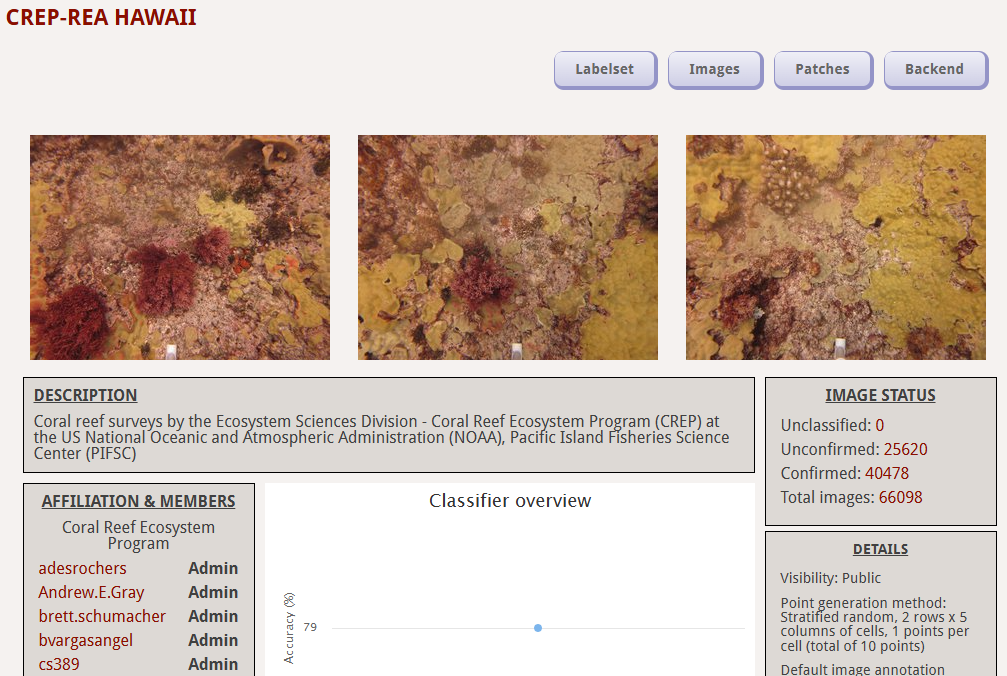
How to download and use our data
Metadata is distinguished by region and site type (fixed or random). Raw imagery is archived separately and is accessible under 'Related Items' for each region's benthic cover metadata record (see Access Raw Data below). Access the CoralNet Bleaching Classifier, or current NCRMP CoralNet sources we are working with - ESD_REA_HAWAII_v2 - ESD_REA_MARIANA_v2 - ESD_REA_SAMOA_PRIA_v2.
SOPs
Ecosystem Sciences Division Standard Operating Procedures: Data Collection for Rapid Ecological Assessment Benthic Surveys, 2019 Update.

Data Sheets
The 'DiveNav' sheet is used to collect metadata for site, latitude, longitude, date, reef zone, and habitat type.

Access Raw Data
Raw data is archived with NCEI. Links for each year are listed in the 'Distribution Information'section of respective InPort metadata records - Hawaiian Archipelago since 2013 - American Samoa since 2015 - Mariana Archipelago since 2014 - Pacific Remote Island Areas since 2014.

R Code for Processing
Contact Thomas Oliver (thomas.oliver@noaa.gov) for processing scripts.