Providing a snapshot of fish assemblages across Pacific coral reefs
SOP, data processing and R code can be accessed in this 2017 publication and other aspects of rapid ecological assessment (REA) survey methods are also described in this 2015 SOP. Surveys are conducted in hard-bottom habitat in water <30 m, following a stratified-random sampling site design (StRS). Random sites are generated across islands using reef zone, depth zone, pre-determined sectors, and locations of known hard-bottom habitat (typically from backscatter data), using the R project ncrmp_common_map.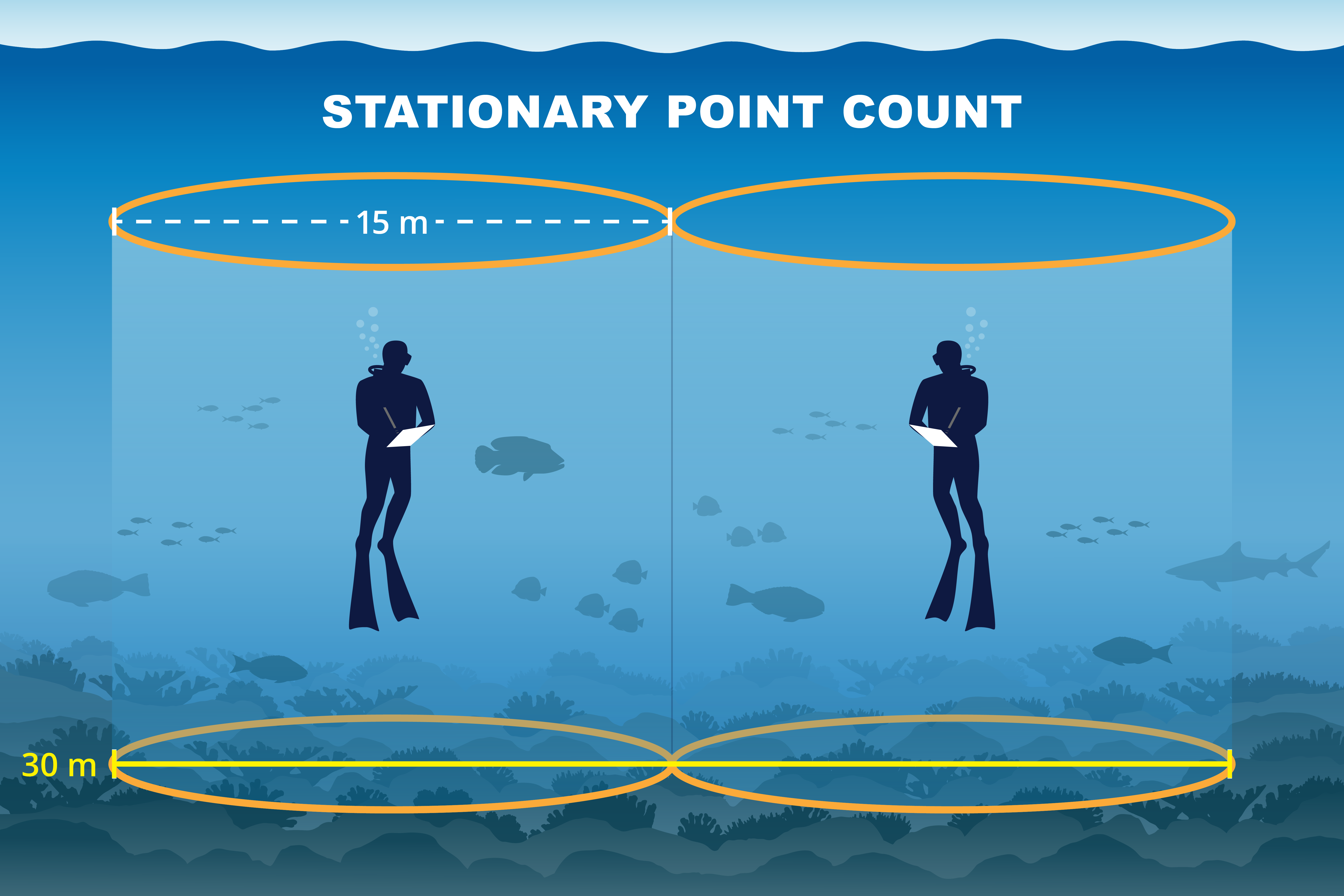
How to download and use our data
To analyze raw data, follow the protocols and references detailed in the NCRMP Fish Protocols - Pacific. To view and download summarized data, you can use the NCRMP Data Viz Tool's NCRMP Pacific Fish Dashboard. Guidance on downloading from the NCRMP Data Viz Tool.
SOPs
Coral reef ecosystem program standard operating procedures : data collection for rapid ecological assessment fish surveys (2015).

Data Sheets
Includes data entry for fish observations with benthic estimate data and/or structure-from-motion belts, printouts for the Secchi disk (for other side of dive slate to measure visibility), and a pre-dive boat box gear checklist.
Access Raw Data
Raw data is archived with NCEI. Links for each year are listed in the 'Distribution Information' section of respective InPort metadata records - Hawaiian Archipelago since 2013 - American Samoa since 2015 - Mariana Archipelago since 2014 - Pacific Islands Heritage Marine National Monument since 2014 . Access Pacific-wide data from 2000 - 2007 and 2007 - 2012.

R Code for Processing
Contact Andrew Shantz (andrew.shantz@noaa.gov) for processing scripts.