Visualize NCRMP Random Site Data via NOAA Data Viz Tool / NOAA GeoPlatform
- Browse by dashboard type to view and download data. For caveats and more on the NCRMP program, including surveys in the Atlantic here.
Note: this only includes random site data.
Raw Data via NCEI / Described on InPort
- Raw data is archived with NCEI within Collections and can be searched using NOAA’s OneStop Platform.
- NCRMP data is typically submitted by mission, and each dataset will have a specific landing page with NCEI. To access links for all missions for a given datastream, refer to the InPort metadata record.
- When searching data, note the distinction for site type and region. For example fixed-site imagery is described separately from random site imagery for each distinct region. For convenience, Ecosystem Sciences Division InPort metadata can be browsed here: Browse Available ESD Metadata or you may browse within the InPort PIFSC CREP Metadata Portfolio.
- For inquires on how to best work with NCRMP data and sampling design please contact nmfs.pic.credinfo@noaa.gov.
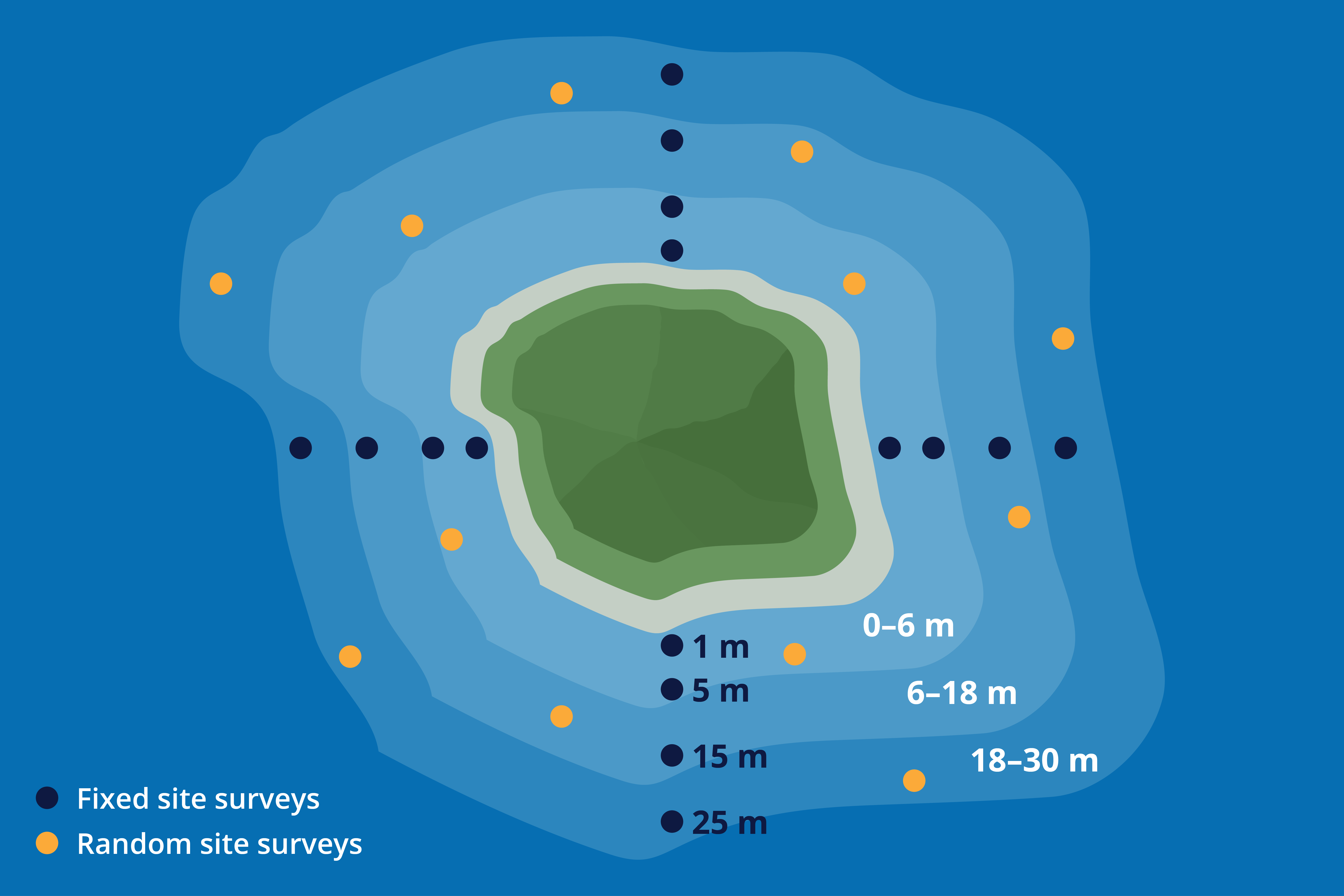
Diagram illustrating fixed versus random site locations for a given hypothetical island. Credit: NOAA Fisheries

Data may be organized into Hawaiian Archipelago, Mariana Archipelago, American Samoa, and Pacific Heritage Islands Marine National Monument (formerly Pacific Remote Island Areas). Credit: NOAA Fisheries
SfM/Photogrammetry Imagery via Google Cloud Bucket (NODD)
- Due to the size of structure-from-motion (SfM) imagery, raw imagery as well as products are available via our Google Cloud Bucket. Raw imagery is archived with NCEI and available on the OER Portal.
- For assistance and tools on how to adopt a similar strategy at your institution, contact the Data Services Team at nmfs.pic.credinfo@noaa.gov.
R Processing Scripts
- Our data is still being updated into public-ready form and will become available on PIFSC github.
Public Tools
See our PIFSC github for python-based tools to assist with processing imagery for NODD, imagery validation, etc.
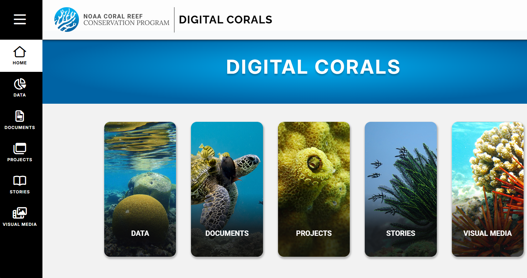
Access Data via Digital Corals
The NOAA Coral Reef Conservation Program organizes projects with data access on Digital Corals. Only looking for NCRMP? NCRMP data here.
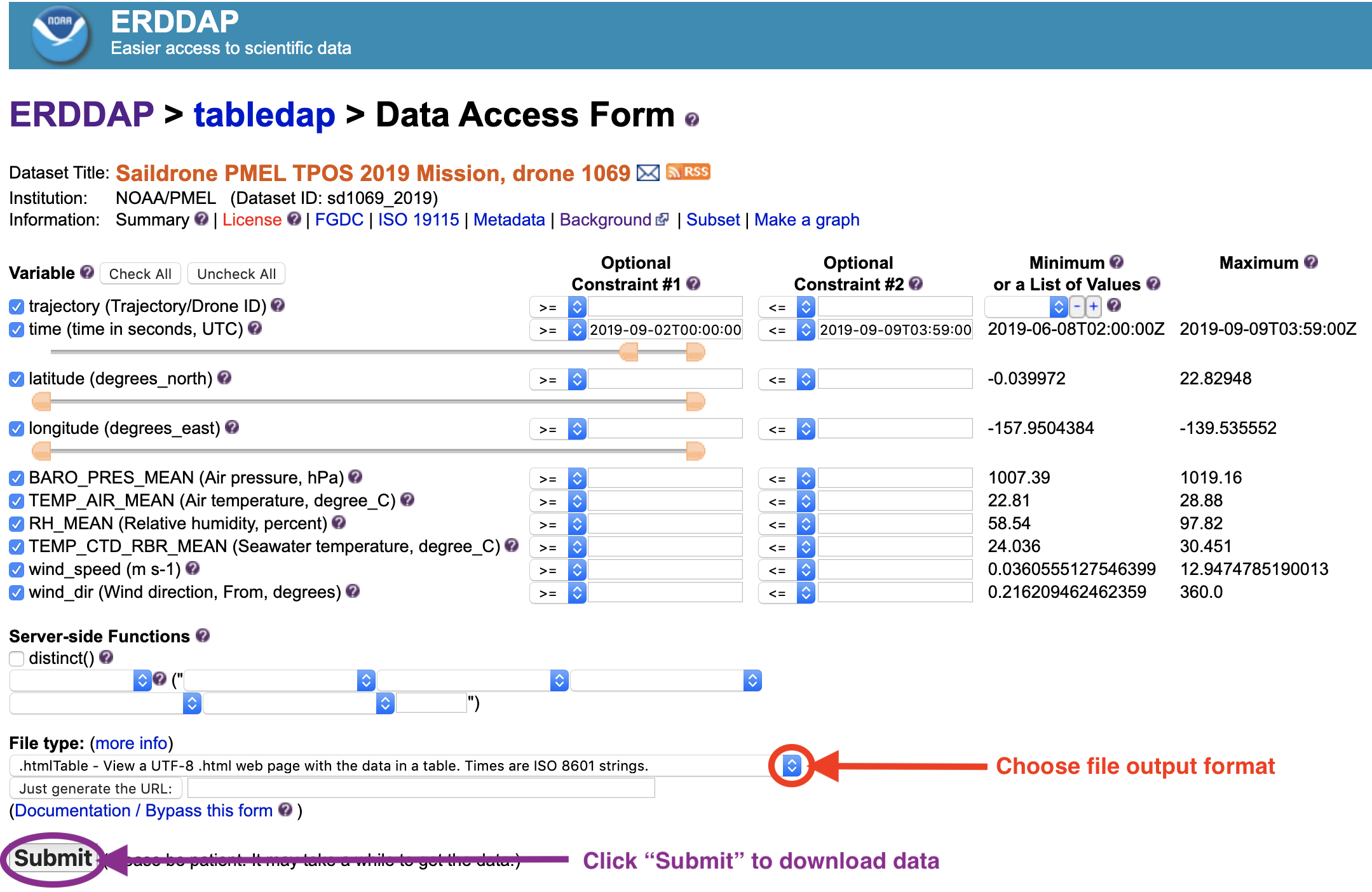
CRCP ERRDAP
Go to tabledap to see CRCP datsets or use the video tutorial provided.